
 The MTTplus' SkyView is an (optional) test tool used to verify GNSS antenna installations and distribution systems (requires the multi-band GNSS receiver hardware option). It helps understand the quality of the signals being received, supported constellations, frequency bands, and the presence of any obstacles blocking the antenna's view to the sky. Whether it is characterizing or troubleshooting an existing installation or validating the performance of a new one being received from a contractor/vendor, the SkyView tool helps map the reception patterns without having to climb to the roof. The results include the performance of the complete GNSS RF distribution system, including antenna, cables, lightning arrestors, amplifiers, splitters, etc. The results are presented as a polar map, representing the 360º x 180º (dome) reception quality pattern from the point of view of the antenna.
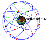
Original SkyView 2017 Version (Single band, Dual constellation)

SkyView 2024 Version (Dual band, Quad constellation)

The MTTplus' SkyView™ test application uses the (optional) GNSS receiver to create detailed reception signal quality (coverage) maps for the antenna under test, based on the carrier-to-noise density (C/No) measurements from all supported satellite vehicles (SV) in view. The C/No is constantly recorded for each of the satellites in view, as they pass by the antenna's "field of view", which over time creates a color-coded signal quality trail. Long term, those trails create a "heat" map representing the 360º by 180º degrees field of view (reception pattern) of the antenna under test.


Carrier-to-noise density, in dB-Hz, is plotted from red (Bad/Poor RF signal reception) to green (Excellent/Good signal quality), to allow the detection of obstructions and blind spots. Ideally, you would want to see all green towards the center of the polar graph (open sky) and marginal or bad at lower elevation angles (<15º, towards the horizon). You may also expect to see some degraded performance in certain directions, due to known unavoidable obstacles, like trees, mountains, nearby buildings, etc.
The SkyView test application supports GPS, GLONASS, Galileo, and BeiDou satellite constellations simultaneously. The constellations and bands to be used for the test depend on the GNSS receiver installed on the test set and the capabilities of the antenna under test. With the latest multiband GNSS receiver, up to two frequency bands for each of the four major satellite systems, allowing it to paint coverage maps quicker and more accurately.

Since GPS is a geosynchronous system, with orbit times of 1/2 of a sideral day, it is recommended to combine the GPS constellation with any of the other satellite systems, which don't have orbital cycles that are exact multiples of the sideral day, like GLONASS (8/17), BeiDou (9/17) or Galileo (10/17). Their trails will be slightly offset (with reference to the antenna's ground position) every time they complete each orbit, helping to paint a better coverage picture by slowly scanning the sky, drawing different trail lines each time. The different datasets are combined to create a complete coverage pattern for the antenna under test.

Using The SkyView Feature
To launch the SkyView test application, tap on the ![]() System Utilities button (on the top-left corner of the screen), if required, and use the menu on the left to go to >Tools >Advanced >More >GNSS Sky View & Antenna Verification. Insert a FAT32 USB memory stick into the test set. Enter a descriptive file name. Connect the antenna cable to the GNSS receiver's SMA connector, using a short flexible adapter cable. Select the applicable satellite constellations (supported by the antenna under test), turn the GNSS receiver ON and give it a few minutes to acquire its coordinates and satellites in view, before you Start the test (data recording).
System Utilities button (on the top-left corner of the screen), if required, and use the menu on the left to go to >Tools >Advanced >More >GNSS Sky View & Antenna Verification. Insert a FAT32 USB memory stick into the test set. Enter a descriptive file name. Connect the antenna cable to the GNSS receiver's SMA connector, using a short flexible adapter cable. Select the applicable satellite constellations (supported by the antenna under test), turn the GNSS receiver ON and give it a few minutes to acquire its coordinates and satellites in view, before you Start the test (data recording).
- It is recommended to release any other test applications, before starting the SkyView test application.
- A paid license (software option) is required for this feature to become available.
- The GNSS receiver option (hardware) is required to run Sky View tests.
The test set stores the coverage image in polar form and the C/No data log. Once the test is stopped, they can be saved to a FAT32 USB memory stick for further analysis and reporting.
The data transfer to the USB memory may take a couple of minutes, due to the large amount of information captured.
Generating Reports
An Excel template is available for simple report customization. Optionally, users can select to record the satellites' data to replay it back on the test set (This requires large amounts of storage memory).
Please refer to the following SkyView Quick Guide link to download a PDF guide and sample Excel template, with further information.
Can SkyView be Used to Detect Jamming and Spoofing?
Although it is not the main purpose of this tool, it will record some of the effects from intentional or unintentional intrusion or impairments.
Jamming: In the presence of external interference, it is expected that the C/No density of all affected constellations and/or frequency bands to degrade all across the SkyView graph (heat map), if the event occurs during testing. Users can show and hide individual constellations, to see possible effects. The SkyView map is not capable of detecting directionality to identify possible source(s).
Since the graph operates in Max Hold mode, the effects of temporary interference may not be visible on the map after a while. However, the .CSV file can be used to dig in any C/No degradation details and time frames, with the use of a spreadsheet application.
Spoofing: Since spoofing attempts tend to modify the location (coordinates), any apparent movements of an otherwise stationary antenna will be recorded in the .XML file, in GPX format. Users can import the file into a mapping application, to show the trail and confirm if any significant position changes took place during the test.
What's New in SkyView 2024 Version?
Starting with MTTplus Platform version 03.00.0012, the SkyView application was completely revamped. Compared to the original 2017 version, these are some of the changes:
- Added support for dual-band quad GNSS antennas, using VeEX’s dual-band quad-constellation GNSS receiver card (optional P/N: Z99-99-034P), to track any combination of GPS (L1C/A, L2C), Galileo (E1B/C, E5B), GLONASS (L1OF, L2OF), and BeiDou (B1I, B2I) bands. Older MTTplus platforms can be easily upgraded with newer multiband receivers. The increased number of available satellite signals helps in significantly reducing the time required to get a full antenna reception map.
- Expanded C/No (Signal Quality) table, to accommodate the tracking of up to 75 satellite signals.
- Optimized the GNSS antenna coverage mapping application’s internal data recording scheme to improve the overall performance and stability of the MTTplus platform.
- Its new Max Hold recording mode helps filter temporary RF signal degradation that could be caused by clouds, rain, ionospheric events, large birds perching on the antenna, etc.
- Users can now turn individual satellite constellations ON and OFF on the SkyView graph to see their individual signal quality maps and compare antenna performance for the supported constellations. It is easier to validate if the antenna and/or amplifiers under test fully support the advertised or expected constellations and frequency bands.
- Recordings now stop automatically, after 72 hours, which should be enough data logging for modern multi-constellation multi-band antennas. Modern antennas and receivers can create good C/No signal quality coverage graphs in 24 hours. Selecting GPS (geosynchronous) with one or more non-geosynchronous GNSS system helps increase the sky coverage and reduce the time to paint the “heat” map. For example, using GPS+Galileo, or even better, using all four constellations (if supported by the antenna under test).
- Test data files (results) are now automatically saved and transferred to the USB memory stick when a test is stopped.
- Improved final GNSS reception quality map image (.PNG). It now includes the signal quality scale, coordinates, and combination of GNSS systems being mapped. Now “one image is worth more than a thousand words” since it summarizes the full test.
- Improved .CSV test record format for better spreadsheet graphing, data manipulation, filtering, analysis and reporting. A sample of a customizable Excel template is available here.
- New .GNSSBIN raw data recording (when Save Replay Files is enabled) allows users to reload previous antenna measurements from a USB memory stick and enable/disable individual satellite constellations, to isolate constellation’s data. The recorded data log can be played back at different speeds. Note: This recording produces a large file, so only enable it if you are planning to use it.
- New .XML coordinate recordings in GPS Exchange Format (GPX), a widely used open format that allows waypoint location data to be loaded to mapping platforms, such as OpenStreetMap, GIS.XL for Excel, Google Maps, Google Drive, etc., or users can develop their own post-processing macros or scripts.
- NMEA messages recording is no longer available in this version.
- Polar graphs in Cosine Projection format are not supported by this version.
- All data files exported to USB memory sticks are now contained in a folder structure, for easier record organization.
- Updated Microsoft™ Excel polar report templates, samples and info are now available in the Knowledge Base site: https://veexinc.com/en/knowledge/how-to-create-skyview-gnss-antenna-reception-coverage-reports
Note: Due to the large amount of C/No data being collected and processed for up to four constellations and two bands each, there is a few seconds response delay in redrawing the SkyView map when constellations’ check boxes are enabled or disabled. This is a normal operation.
CAUTION: It is recommended that existing SkyView users try this new version out first, to understand how the new data, data formats and files may impact compatibility with their existing records, reporting and any custom-made post-processing (scripts, macros, apps), before deploying this new platform version to the rest of the MTTplus test set fleet.
Related Test Solutions
- MTTplus - Modular Test Platform
- CX41 - Coaxial Time Domain Reflectometer (TDR)